VFR flight planning for students, pilots and schools

Flight planning for students, pilots and schools. A clear record of every flight.

VectorEFB is an electronic flight bag that runs in the browser on a phone, tablet or laptop. Students plan the route, check the weather and terrain, and record the flight. Instructors see each plan, the briefing behind it and how the flight compared, before and after the lesson.

vectorefb.com/app · MapSNAPSHOT
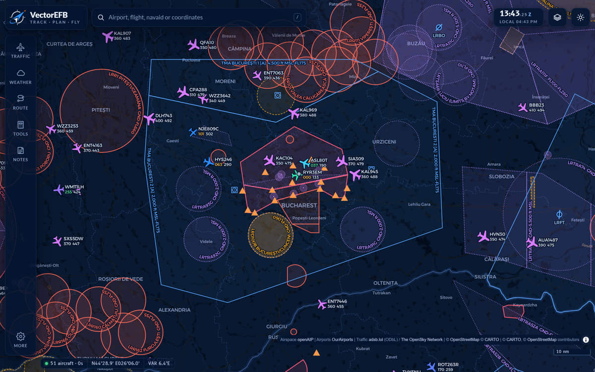
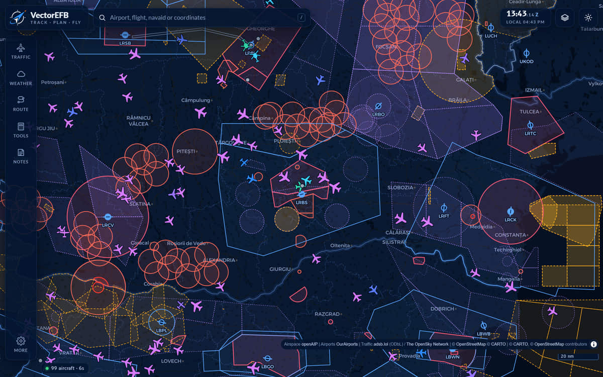
VectorEFB map of central Romania at night with airspace outlines and live aircraft symbols; the left rail shows Traffic, Weather, Route, Tools and Notes.
FIG 1Live traffic and airspace over central Romania, standard night map.

In the app today

22,251
airports and airstrips
11,008
navaids
37
countries of airspace data
9
weather layers
12
calculators
10
plan checks a school can flag

Airports and navaids from OurAirports, built 12 November 2026. Airspace from openAIP. Counts taken from the product, not estimated.

Working with

Freqwise

Freqwise is a web app, made in Bucharest by Readback Labs, for practising radio calls out loud. A simulated controller on a practice airfield answers and corrects your readbacks, using English radiotelephony and SERA phraseology. It is built for European student pilots, with an instructor view for flight schools. We are working with them so that planning here and radio practice there fit together. It is a training aid, not real ATC and not approved flight training.

Visit freqwise.com (opens in a new tab)

Try a readback

The controller says this. Tap what you would read back, in the order you would say it.

Start here

Which one are you?

Pick the closest fit. Each has its own page with what it does and why to choose it. VectorEFB is in private pre-launch, so access is by request.

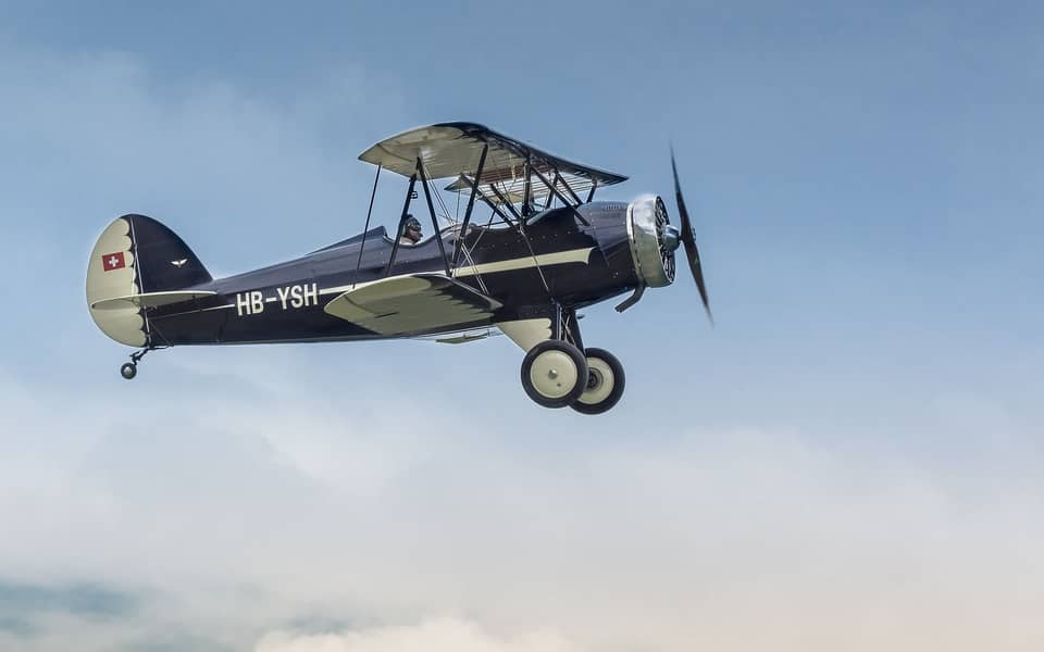
A vintage biplane in flight against a blue sky, the pilot visible in the open cockpit.

Pilot

Flying on your own, or checking the day before you go.

  • Live traffic, airspace and weather on one map: METAR, TAF, SIGMET and radar
  • Route planning with a nav log, forecast winds and a terrain profile
  • Print a briefing pack, and use the map with no signal once you have downloaded the area
  • 12 calculators, from holding patterns to fuel and weight and balance
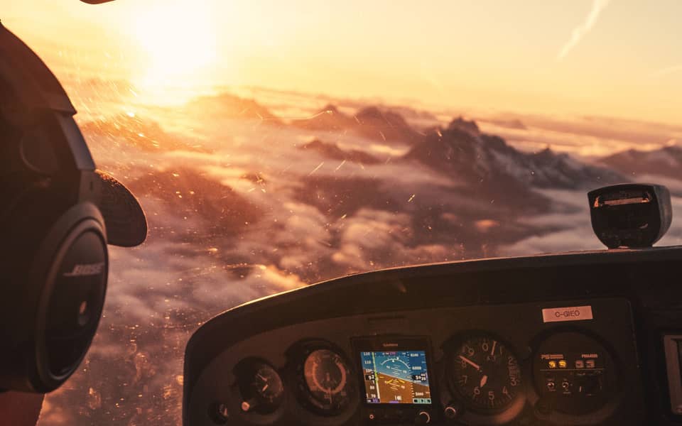
View from the left seat of a light aircraft at sunrise: a pilot in a headset looking out over cloud and mountain peaks, the instrument panel below.

Student pilot

Training towards a licence, with an instructor to answer to.

  • Work out the flight plan yourself, have the app check your figures, then send it to your instructor
  • See the same warnings your instructor will: a short reserve, no alternate, an old weather briefing, cruise below the terrain
  • Record the flight from your phone or tablet, then replay it and read the debrief
  • A logbook that fills in from your recorded flights
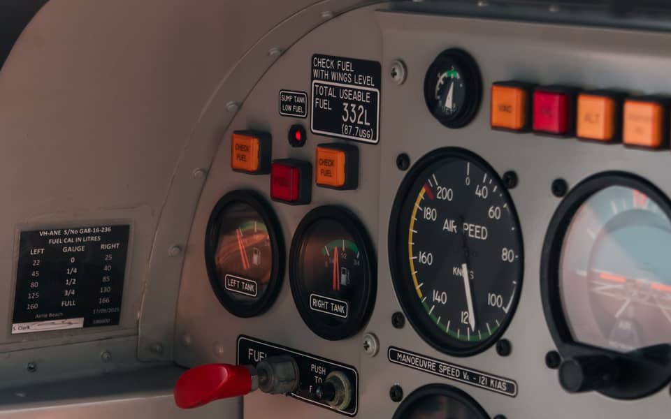
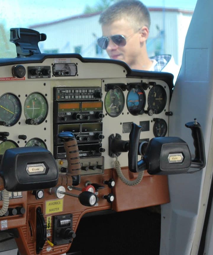
Close-up of a training aircraft instrument panel with fuel gauges, a fuel calibration card and an airspeed indicator.

Flight school

Instructors and heads of training who want to see the work before the lesson.

  • Every plan in one record, with red flags and the briefing behind it
  • Recorded flights you can replay, with a debrief written against the plan
  • Scheduling for aircraft, rooms and instructors, and work set between lessons
  • Your own standards, and safety reporting for the school

Private pre-launch

Request access

VectorEFB is in private pre-launch. Tell us who you are and we will email you when you are approved. Then you can plan the flight, check the weather and terrain, and keep your routes, waypoints and recorded flights on every device.

  • Free. No card, no advertising.Free of charge today. If we ever add paid plans you will see the price before you agree to anything, and free features get 30 days’ notice before they end.
  • Saved routes, waypoints and aircraft follow you between devices
  • Flights you record are kept in your accountRecording is new. Keep your usual logbook alongside it.
  • Download or delete your data from Settings, whenever you like
  • No ads
  • No tracking cookies
  • 16 and over

Request access

It takes about a minute. We approve each person by hand.

I am a

A training and situational awareness aid, not certified for navigation.

Sunrise over cloud and mountain peaks, seen from the cockpit of a light aircraft.

Plan · Fly · Learn

Plan it on the ground. Fly it. Learn from it.

One record follows the flight from the briefing to the debrief, so the student and the instructor are looking at the same thing.

See how a lesson works

On the tablet

See it on an iPad

A short walkthrough of the pilot app at iPad size: look up an airport, build a route, read the nav log and the terrain under it, then check the weather. It runs in the browser, so there is nothing to install.

Screen recording, sped up.

Screen recording of the VectorEFB pilot app on an iPad. The pilot searches for Brasov airport and reads its weather, adds two more airfields to build a route, opens the nav log and the terrain profile, then switches on the rain radar.

Screen recording of the VectorEFB flight-school area on an iPad. An instructor looks at the day’s bookings, opens the planning record and one plan with its red flag, replays a recorded flight and reads its debrief, then opens a student’s logbook and the safety overview.

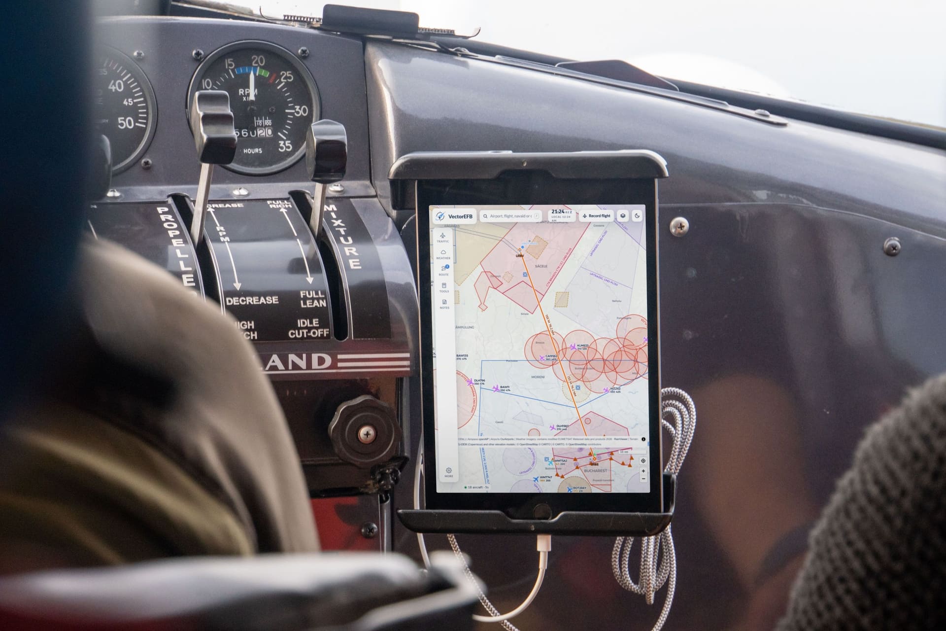
An iPad mounted on the instrument panel of a light aircraft, showing the VectorEFB map with a route from Brasov to Bucharest. The screen is an illustration added to a stock photograph.

01  Pilot toolkit

From the first look at the weather to the printed briefing pack

This is what is in the app now. Free public data feeds it, and each layer says where it comes from and how old it is.

  1. 01 / 07  Traffic and airspace

    See what is around the airfield

    Live ADS-B traffic is drawn over airspace with its vertical limits, reporting points and navaids. The status bar shows how many aircraft are in view and how many seconds old the data is.

    • Datablocks: callsign, flight level, groundspeed
    • Emergency squawks 7500, 7600 and 7700 are alerted
    • Limit: aircraft that do not broadcast a position never appear. An empty map is not an empty sky.
    VectorEFB night map zoomed on Bucharest. Airspace outlines and reporting points surround the airport, and aircraft symbols carry datablocks with callsign, flight level and groundspeed. The status bar at the lower left counts the aircraft in view and the age of the data.
    FIG 2Standard night map around Bucharest, airspace and traffic on, datablocks drawn.
    Open the full screenshot
  2. 02 / 07  Weather

    Weather on the map, with its age

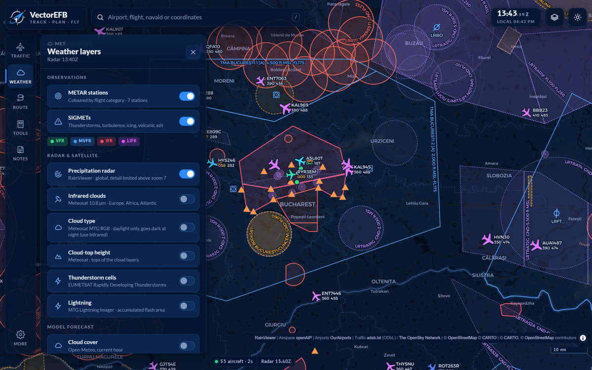
    Airports are coloured by flight category. SIGMETs, precipitation radar, Meteosat cloud type and top height, storm cells and lightning share the same map, with forecast winds aloft and cloud cover from a model. Each layer has its own update cycle, so use imagery for the big picture.

    • VFR green MVFR blue IFR red LIFR purple
    • 9 weather layers
    Weather layers panel over the night map. Switches for METAR stations, SIGMETs and precipitation radar are on; cloud type, cloud-top height, storm cells, lightning and model layers are off. A legend row shows the four flight categories.
    FIG 3Weather panel with METAR stations, SIGMETs and precipitation radar switched on.
    Open the full screenshot
  3. 03 / 07  Airport briefing

    METAR and TAF, decoded, with the time

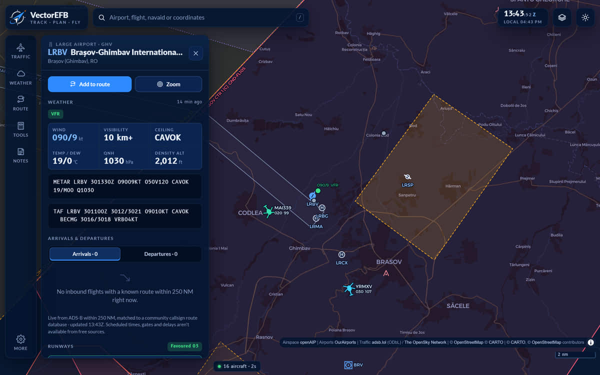
    Open any airport for its latest METAR and TAF next to the raw text, each with its observation time. Runway headwind and crosswind, density altitude, sunrise and sunset and frequencies are on the same page. If an airport publishes no METAR, the app says that, and says something different when the weather service cannot be reached.

    Airport panel for LRBV, Brasov-Ghimbav International. It shows a VFR flight category, wind 080 at 8 knots, visibility 10 kilometres or more, CAVOK, temperature 19, QNH 1031 and density altitude 1,974 feet, above the raw METAR and TAF text.
    FIG 4Airport page for LRBV, Brasov-Ghimbav.
    Open the full screenshot
  4. 04 / 07  Route and nav log

    A nav log you can fly from

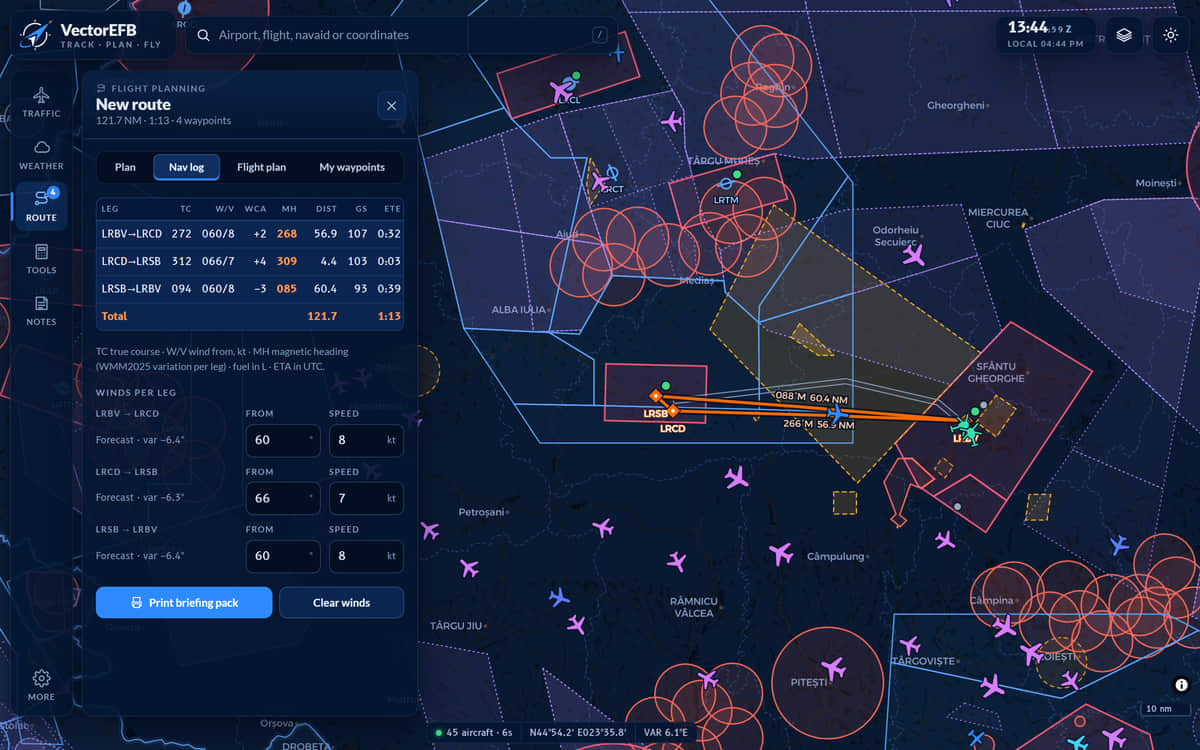
    Tap the map to add waypoints, or search airports, navaids and reporting points. Fetch forecast winds for each leg and the nav log fills in true course, wind correction, magnetic heading, distance, groundspeed, time, ETA and fuel, with the fuel remaining at the end of each leg.

    • Magnetic variation from WMM2025
    • Print it, export GPX, or build an ICAO flight plan message to copy into your filing system. VectorEFB does not file it.
    Route panel on the Nav log tab. A table lists three legs from LRBV with true course, wind, wind correction angle, magnetic heading, distance, groundspeed and time, totalling 121.7 nautical miles and 1 hour 13 minutes. Winds per leg are listed below. The route is drawn in orange on the map.
    FIG 5Nav log for a three-leg route from LRBV, TAS 100 kt, cruise 5,500 ft, forecast winds fetched. The table continues to the right with ETA and fuel.
    Open the full screenshot
  5. 05 / 07  Terrain

    The ground under the route

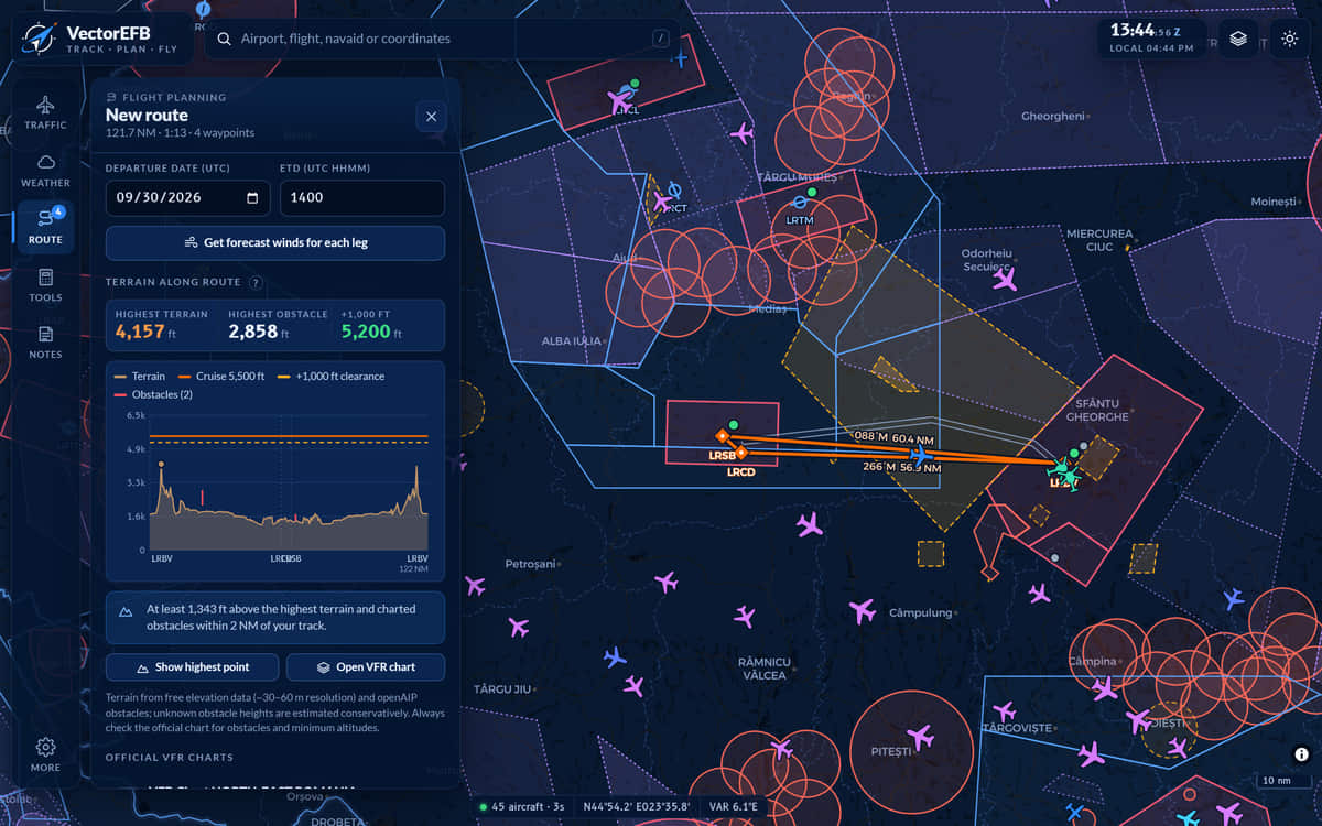
    A side view draws the terrain and obstacles within 2 NM of track against your cruise altitude, and warns when you would have less than 1,000 ft above the highest. On the VFR chart, grid figures give the highest terrain or obstacle in each square with a margin added.

    • Built from public elevation models and obstacle data. It is a check, not a clearance.
    Terrain along route panel. Tiles give the highest terrain as 4,157 feet, the highest obstacle as 2,858 feet and the cruise altitude plus 1,000 feet as 5,200 feet. A profile chart shows terrain well below the 5,500 foot cruise line, and a note says the route is at least 1,343 feet above the highest terrain and charted obstacles within 2 nautical miles.
    FIG 6Terrain profile for the same route with cruise at 5,500 ft. Highest terrain 4,157 ft.
    Open the full screenshot
  6. 06 / 07  Before you leave

    Download the area before you leave

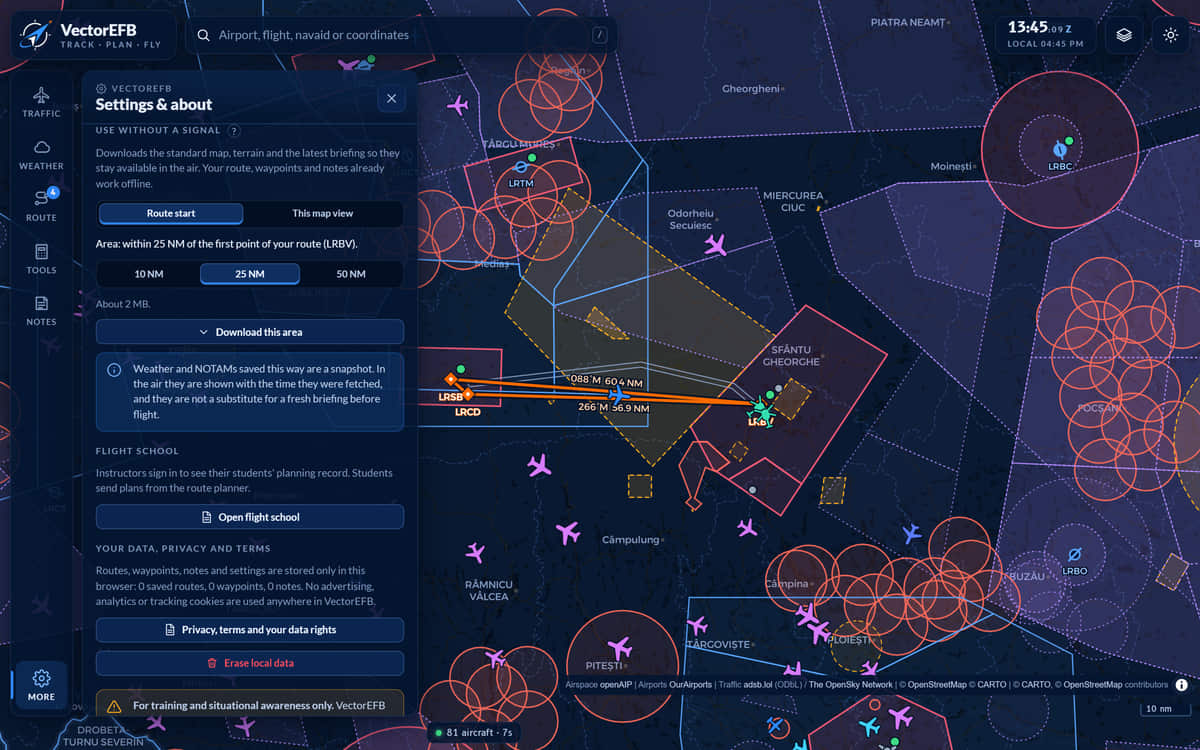
    Download the area around your airfield (10, 25 or 50 NM) before the lesson. The downloaded map and terrain, your route and nav log, the calculators and the notepad then work with no signal. Live traffic and fresh weather do not. Weather saved this way is a snapshot, shown with the time it was fetched.

    • Areas of 10, 25 or 50 NM around a departure airfield
    Settings panel section titled Use without a signal. A selector offers Route start or This map view, and three area sizes, 10, 25 and 50 nautical miles, with 25 selected and an estimate of about 2 megabytes above a Download this area button.
    FIG 7Settings, Use without a signal. Nothing has been downloaded in this view.
    Open the full screenshot
  7. 07 / 07  In the aircraft

    Recorded while you fly

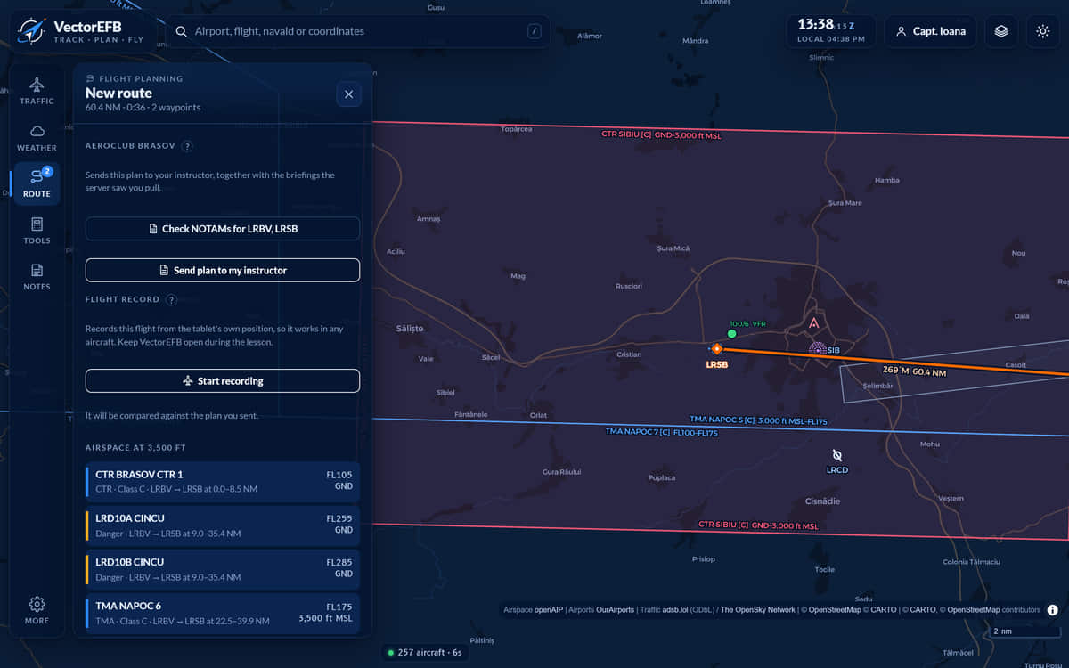
    In a student account, the Route panel has a Flight record control. It records the flight from the phone or tablet’s own position and keeps working with no signal. The flight is kept on the device and sent when it is online again. Keep the app open and the screen on.

    Recording is new. It has been tested in the lab but not yet on a real flight, so keep your usual logbook alongside it while it is proven.

    • Recording uses the device’s GPS. Wi-Fi-only tablets have none.
    • Recording starts only when the student presses Start recording
    Route panel for a demonstration student. Buttons read Send plan to my instructor and Start recording. Under the Flight record heading, text says the flight is recorded from the tablet’s own position and that VectorEFB should stay open during the lesson.
    FIG 8Route panel in a student account. Recording has not been started.
    Open the full screenshot

02  Also in the app

The smaller tools

Calculators (12)
Holding pattern entry drawn on the map, wind triangle, crosswind, density altitude, true airspeed, fuel, descent, weight and balance with the CG envelope, runway performance, checklists, unit converter, daylight and civil twilight. Weight and balance starts from the aircraft’s saved empty weight and arm. Landing distance is also shown for a 5 kt tailwind, because the wind can turn.
Notes
Kneeboard templates for ATIS, CRAFT clearance, position report, departure brief and PIREP, each with a UTC stamp.
My waypoints
Long-press the map to save a point. Searchable, addable to a route, exportable as GPX.
Synthetic vision
A 3D view forward from any tracked aircraft, over real terrain. Pitch and bank are estimated from climb and turn rate, because ADS-B does not transmit attitude.
Installing
Add to the home screen on iPad, iPhone, Android or desktop. It runs full screen.

03  Flight schools

What the instructor sees before the lesson, and after it

Students plan in the normal app and send the plan to their instructor. The school area shows the plan, the briefing the server logged, how the flight went, and the school’s safety reports. The screens below show a sample school (about the screens).

  1. 01 / 08  Schedule

    One board for aircraft, rooms and instructors

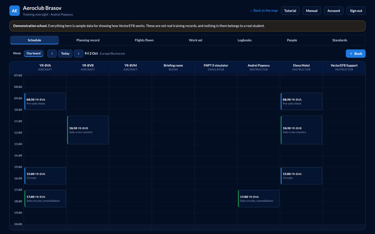
    The day board has a column for each aeroplane, briefing room, simulator and instructor. A booking is checked against all of them at once, so nobody is in two places and no aeroplane is in two details. An aeroplane in maintenance or marked out of service cannot be booked. Times show in the school’s timezone.

    • Lesson, solo, ground school, simulator, skill test, maintenance
    • Back-to-back bookings are allowed
    Day board for Aeroclub Brasov on Friday 2 October. Columns for the aeroplanes YR-BVA, YR-BVB and YR-BVM, a briefing room, a simulator and three instructors carry booking blocks such as a pre-solo check at 08:30 and circuits at 15:00. A banner states that this is a demonstration school.
    FIG 9Day board, Friday 2 October.
    Open the full screenshot
  2. 02 / 08  Planning record

    Every plan, measured against the school’s own minimums

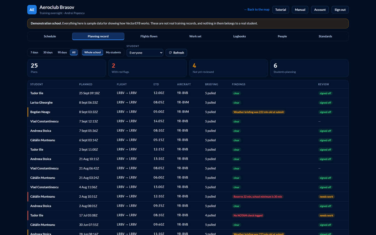
    Each submitted plan is listed with the number of briefings pulled, its flags and its review status. Red means a school rule was broken. Amber is worth a word at the briefing.

    • Reserve 22 min, school minimum is 30 min
    • Weather briefing was 222 min old at submit
    • Ten checks: fuel reserve, fuel margin, no weather briefing, stale briefing, no alternate aerodrome, cruise below terrain, thin terrain margin, terrain not checked, terrain answer lower than the planner found, plan sent too late
    Planning record table for a demonstration school listing 25 plans, with summary tiles for 2 plans with red flags and 4 not yet reviewed. Two rows are marked in red: one with the finding “Reserve 22 min, school minimum is 30 min” and one with another finding, both with the review status “needs work”.
    FIG 10Planning record, all dates. Two red flags among 25 plans.
    Open the full screenshot
  3. 03 / 08  Plan review

    The evidence behind a plan

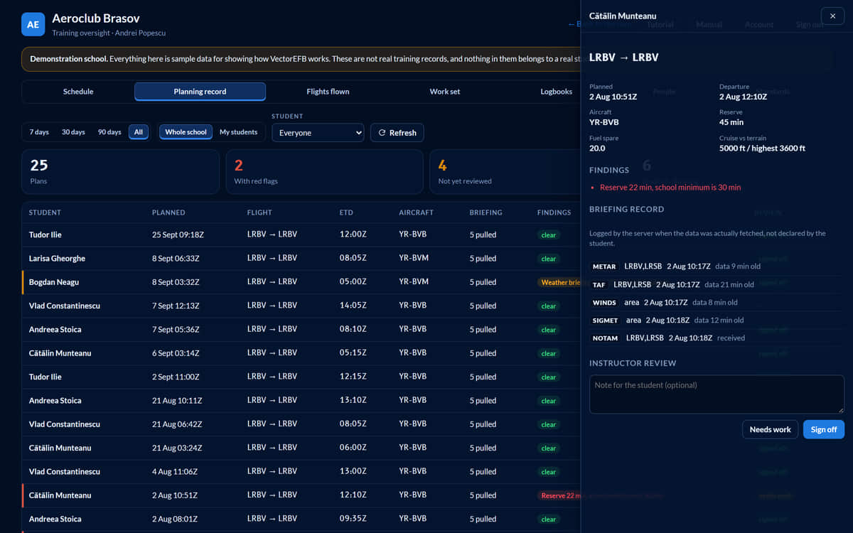
    Open a plan for the route, the fuel and terrain figures and the briefings the server logged: what was asked for, when, and how old the data was. The times are the server’s, so a student’s device cannot backdate them. Sign the plan off, or mark it as needing work with a note the student will see.

    • A compliance record, not tamper-proof evidence. It shows who prepared, not who understood.
    Plan detail panel beside the planning table. It lists the planned and departure times, aircraft, reserve of 45 minutes and the finding “Reserve 22 min, school minimum is 30 min”. A briefing record shows METAR, TAF, winds and SIGMET entries, each with the time it was fetched and how old the data was, above the instructor review controls.
    FIG 11Plan detail with the briefing log. Nothing on this screen was changed.
    Open the full screenshot
  4. 04 / 08  Replay

    Fly the lesson back

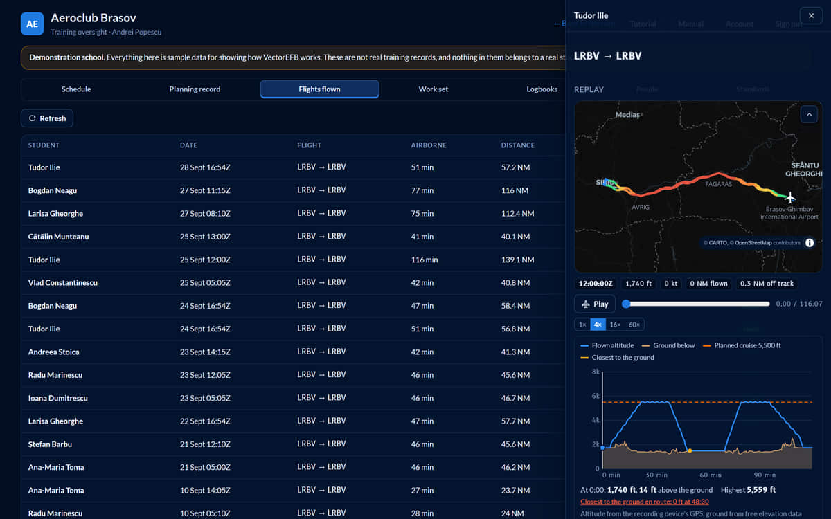
    Many light training aeroplanes broadcast no position, so the student’s phone or tablet records the track from its own GPS. The replay draws the track coloured by altitude, and plots the altitude flown against the planned cruise level and the ground beneath it. Play it at 1x, 4x, 16x or 60x.

    Replay drawer for a 116-minute flight. A map shows the coloured track between Sibiu and Brasov, with playback controls at 1x, 4x, 16x and 60x. Below, a chart plots flown altitude, the ground below and a dashed planned cruise line at 5,500 feet over two climbs.
    FIG 12Replay of a 116-minute flight. Planned cruise 5,500 ft.
    Open the full screenshot
  5. 05 / 08  Debrief

    Planned against flown

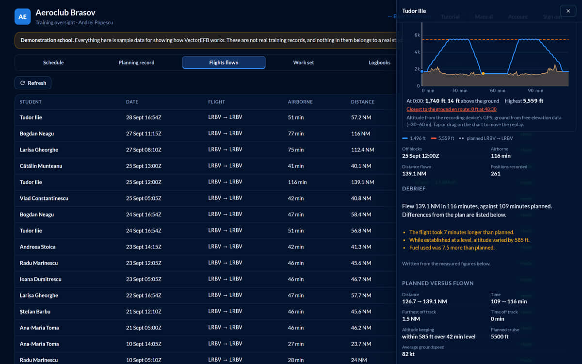
    When the flight is sent, it is compared with the plan: time, distance, the furthest off track and for how long, how well the cruise level was held, average groundspeed, fuel and any planned waypoint not reached. The written debrief is composed by rules from those measured figures, and no outside service sees the flight, so the words cannot disagree with the numbers.

    Lower part of the replay drawer. A written debrief says the flight covered 139.1 nautical miles in 116 minutes against 109 minutes planned and lists three differences. Below it, planned-versus-flown figures give distance 126.7 to 139.1 nautical miles, time 109 to 116 minutes, furthest off track 1.5 nautical miles and altitude kept within 585 feet.
    FIG 13Same flight, scrolled to the debrief and the planned-versus-flown figures.
    Open the full screenshot
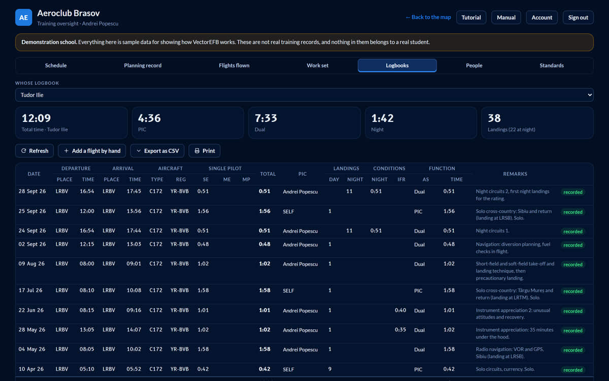
  6. 06 / 08  Logbook

    A logbook the recording fills in

    The logbook is laid out with the columns of an EASA pilot logbook. A recorded flight fills in what it can prove, including night time worked out from the track against civil twilight. It does not guess who was in command, or what was dual or instrument time: the pilot enters those, and the pilot’s correction always wins. Export as CSV or print.

    • A convenience copy. The official logbook remains the pilot’s responsibility.
    Logbook of a demonstration student with totals for total time, PIC, dual and night time, and 38 landings of which 22 at night. The table has columns for date, departure, arrival, aircraft, single-pilot time, total, PIC, landings, conditions, function and remarks, and rows for night circuits marked recorded.
    FIG 14A student’s logbook.
    Open the full screenshot
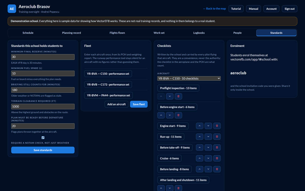
  7. 07 / 08  Standards and fleet

    The school sets the numbers

    Minimum final reserve, how long a briefing stays valid, terrain clearance, how far ahead of departure a plan must be ready, and minimum fuel spare are the school’s own. Each aeroplane gets its performance figures from its POH and its own checklists, written by the school. Two schools can hold different standards.

    • Three aircraft in the sample school: Cessna 150, Cessna 172, Piper PA-44.
    Standards screen of the demonstration school. A card lists the school’s minimums: final reserve 30 minutes, fuel spare 10, briefing validity 180 minutes, terrain clearance 1,000 feet, plan ready 20 minutes before departure. Next to it, a fleet card lists YR-BVA (C150), YR-BVB (C172) and YR-BVM (PA44), each with a performance set.
    FIG 15Standards, fleet, checklists and enrolment.
    Open the full screenshot
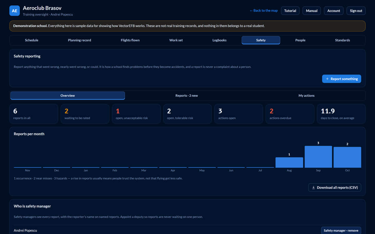
  8. 08 / 08  Safety reports

    Safety reports, from first report to closure

    Anyone at the school can report an occurrence, a near miss or a hazard, with their name or without. The safety manager rates each report on a severity-by-likelihood matrix, gives follow-up actions to named instructors with dates, and closes it with a note the reporter reads. The overview shows what is waiting for a rating, the open risk, overdue actions and reports per month, and every report downloads as a spreadsheet for a safety review.

    • A report filed without a name stores no name at all, so it cannot be traced back to anyone.
    • The risk bands are a common default. Check them against the school’s own safety manual.
    Safety overview of the demonstration school. Seven figures: 6 reports in all, 2 waiting to be rated, 1 open at unacceptable risk, 2 open at tolerable risk, 3 actions open, 2 actions overdue, and 11.9 days to close on average. Below, a bar chart of reports per month over the last year, and a button to download all reports as a spreadsheet.
    FIG 16Safety overview: what is waiting, open risk, overdue actions, reports per month.
    Open the full screenshot

Accounts and the airfield reality

The roster lists everyone in the school with their role, instructor, last plan and whether they have accepted the privacy notice. Sign-in is by school code, username and password, or with a passkey on each device. Students can enrol themselves with the school’s invitation code.

The operator’s console creates and lists schools without a terminal. It uses a named admin account that shows up on each school’s roster.

At the airfield with no signal, a booking or a plan waits on the device and goes when the signal returns, only under the person who queued it. If the server then refuses it, for example because someone booked the aeroplane meanwhile, it stays visible in red instead of vanishing.

Ways to sign in to a school
Sign inHow
PasswordSchool code, username and password
PasskeyRegistered on each device
EnrolmentStudents use the school’s invitation code

On your phone

Put it on your Home Screen

No app store needed. VectorEFB installs from this site, then opens full screen like any other app, with its own icon. It is in private pre-launch, so ask for access first; the steps below work once you are approved.

iPhone and iPad

  1. Open this site in Safari.
  2. Tap the Share button, then Add to Home Screen.
  3. Open VectorEFB from your Home Screen and sign in.

Lesson reminders need iOS 16.4 or later and the installed app.

Android

  1. Open this site in Chrome.
  2. Tap Install the app below, then Install when Chrome asks. Or use the ⋮ menu and Install app.
  3. Open VectorEFB from your Home Screen.
Install the app

While you record a flight, keep VectorEFB open with the screen on: a phone pauses location updates for apps that are not in front. A version that keeps recording with the screen locked is being prepared.

04  Pricing

Free while we work with the first schools

We are working with a small number of flight schools and are not charging yet. Prices will be agreed with each school before anything is billed. If you want to use VectorEFB at a school, write to us and we will set up the school code, load the fleet and standards, and take your instructors through the dashboard.

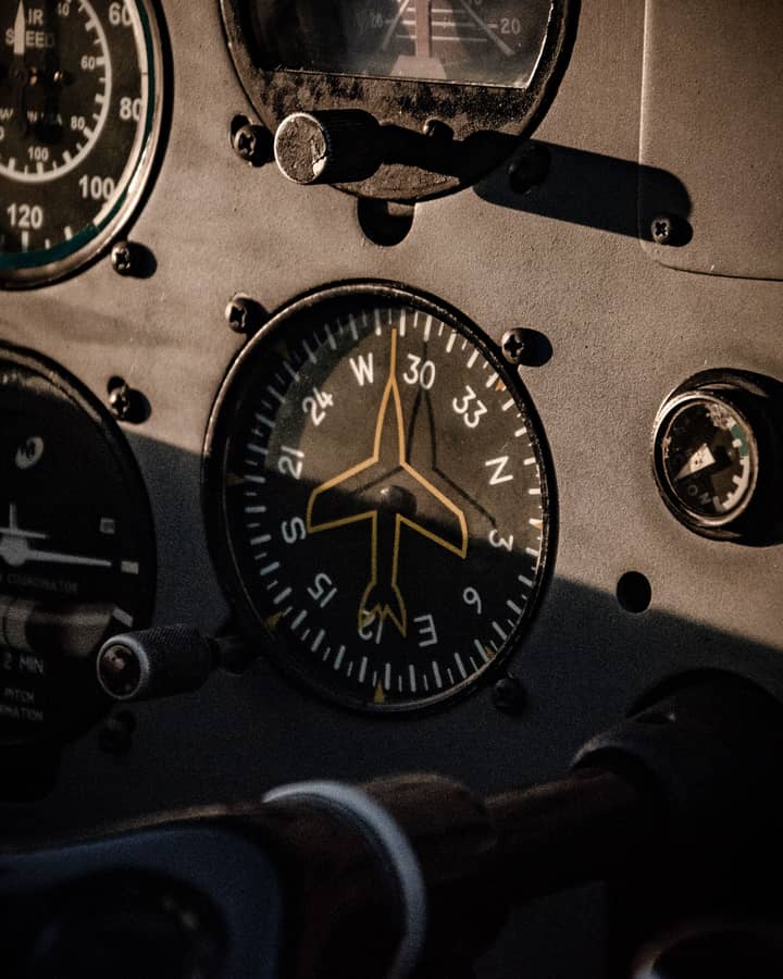
Close-up of a heading indicator on an aircraft instrument panel in low evening light, the aircraft symbol pointing between the headings 30 and 33.
Max, founder of VectorEFB, in sunglasses behind the instrument panel of a Cessna on an airfield.

About VectorEFB

Created by a pilot who knows what schools and pilots need

VectorEFB is made by a private pilot who knows what schools and pilots need: planning, briefing and debrief in one place, and instructors who can see the work before the lesson, not only after it. Students and instructors work from the same record, from the first look at the weather to the debrief.

We are working with flight schools now, and what their instructors and students tell us decides what we build next. If you have a view on how it should work, we would like to hear it.

MaxFounder, VectorEFB · Private pilot · Romania

Talk to us

Tell us about your organisation and what you need. We will reply by email with what setup involves.

For example your airfield, how many aeroplanes and instructors you have, or what you want to solve. Please do not include health or other sensitive details.

Controller: VectorEFB, Romania. We use these details to reply to you and keep the enquiry for 12 months, then delete it. See the privacy notice. Prefer email? Write to contact@vectorefb.com.

Individual pilots can ask for access with the Request access form on this page. A school can choose Flight school there, and we will be in touch.

Data, privacy and limits

Not certified

A training and situational awareness aid. Use official charts, the AIP, NOTAMs and a proper weather briefing for real flights.

Known limits

Aircraft without ADS-B Out never appear. Weather is as old as its timestamp. Terrain is a model.

Your data

No advertising, analytics or tracking cookies. For a school’s students, the school is the data controller.